
Adirondack Rail Trail App
Everything You Need, One App
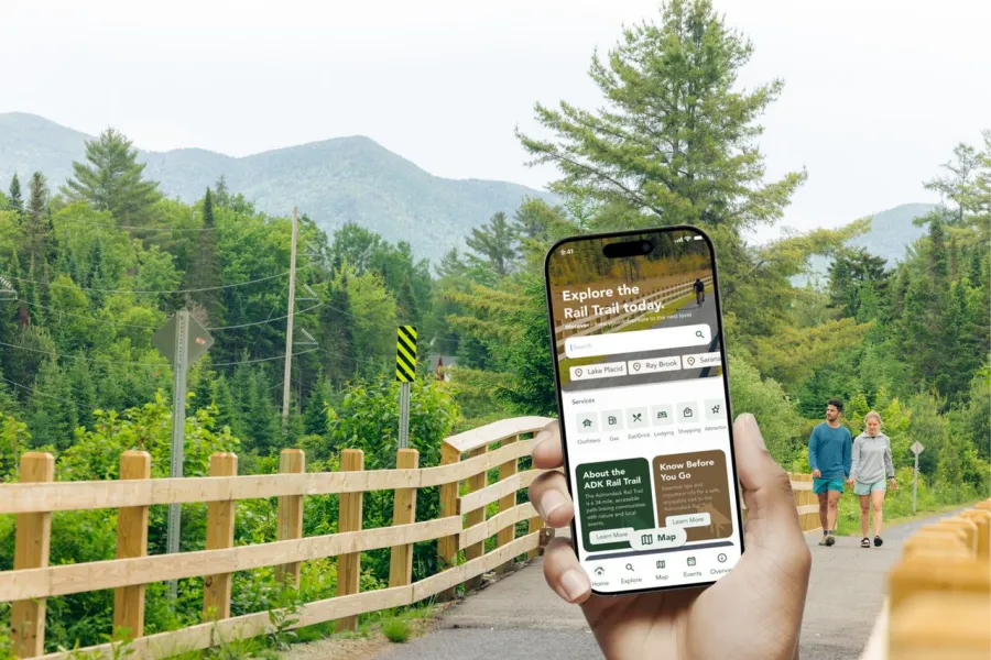
Find everything you need for your Adirondack Rail Trail adventure in one free, easy-to-use app. Featuring interactive maps, mileage markers, trail access points, parking areas, and nearby amenities and attractions, the app makes it easy to plan everything from a quick outing to a full day on the trail.
Use the app to plan your trip before you go, locate trail access points and parking, discover places to stay, eat, and rent gear, explore events near the trail, and stay on track with offline maps.
Download the App
Take the Adirondack Rail Trail with you! Download the app to explore maps, access points, nearby businesses, trail information, and offline navigation wherever your adventure leads. Whether you're planning ahead or exploring on the go, the app makes it easy to find parking, amenities, events, and everything you need along the trail.
Get it on the App Store or Google Play.

Learn more about the Adirondack Rail Trail
The Adirondack Rail Trail is a 34-mile, multi-use corridor through the Adirondacks, linking communities and landscapes in a way few other routes do. Built along a historic rail line, it offers a rare, low-elevation path connecting Lake Placid, Saranac Lake, and Tupper Lake through forests, wetlands, and mountain views that feel both accessible and distinctly wild. Explore it in every season with hiking, biking, snowshoeing, cross-country skiing, and snowmobiling along its full length or shorter sections between communities.

Know before you go
The Adirondack Rail Trail is a shared space for exploring the region’s natural beauty at a relaxed pace. A few simple etiquette guidelines help ensure the trail remains safe, welcoming, and enjoyable for everyone today and for seasons to come.
Before you head out, take a moment to review a few key tips to help make the most of your time on the trail.